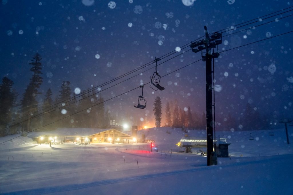
California ushered in the New Year with a dry and disappointing snow pack in the Sierra Nevada — just 25% of the historical average.
But in the month since, like the stock market and the 49ers playoff hopes, the picture has improved significantly. On Monday the snowpack, a vast 400-mile long frozen reservoir that provides nearly one-third of the state’s water supply, had jumped to 52% of normal, boosted by several big storms that have taken ski resorts out of the doldrums in recent weeks and tempered talk of a 2024 “snow drought” that was beginning to take hold.
“We’ve come a long way from where we were at the beginning of the month,” said Andrew Schwartz, lead scientist at the UC Berkeley Central Sierra Snow Laboratory near Donner Summit west of Lake Tahoe.
Between Oct. 1 and New Year’s Day, just 35 inches of snow fell at the UC snow lab site, off Interstate 80. On Monday, that seasonal total had grown to 105 inches. For that location, at nearly 6,900 feet elevation, Monday’s total is 61% of the historical average — a number that while below normal is expected to grow in the coming days.
“There’s still some hope we are going to see a wetter pattern the first few weeks of February,” Schwartz added.
A significant storm system is forecast to hit Northern California and the Sierra from Tuesday night through Friday, with chances of another rolling in Sunday and next Monday.
“It will be on the higher side of the storms we’ve seen this year,” said Katrina Hand, a meteorologist with the National Weather Service in Sacramento. “You could see ponding of water on the roads this week, some creeks rising to near flood stage. And it will bring more snow to the Sierra.”
The storm, an atmospheric river from Hawaii which is expected to be a 2 on a scale of 1 to 5 — with 5 being the strongest — is forecast to dump 1 to 3 inches of rain across much of the Bay Area by Friday. About 3 to 5 inches is expected over the North Bay and up to 4 to 6 inches is forecast for the Santa Mountains and Big Sur.
The heaviest day will be Wednesday, with chain controls expected throughout the Sierra, and gusty winds there forecast to reach 50 mph or more.
By Friday, the storm is forecast to bring up to 2 feet of new snow to the Lake Tahoe area, up to 3 feet farther south at Sonora Pass, and up to 5 feet on Mount Lassen.
California often experiences big swings in the amount of rain and snow it receives each year.
“Every winter, water managers are biting their nails and investing in Pepcid,” said Felicia Marcus, a visiting fellow at Stanford University’s Water in the West Program. “The start to this winter was anemic, but right now, it’s pretty OK.”
As the Earth continues to warm from climate change, scientists say that California is seeing more “weather whiplash” between very dry and very wet years. Eight of the past 12 years have been drought years in the state, punctuated by some drenching years, like 2017 and 2023.
Last year, a series of huge atmospheric river storms battered California, ending the state’s severe 2020-22 drought. Last Feb. 1, the Sierra snowpack was a staggering 212% of normal. By April 1, it was the biggest snowpack in 40 years, at 232% of the historical average. A few ski resorts stayed open until the Fourth of July last year.
The fact that this year has begun much more modestly is in many ways a good thing, experts said Monday.
Reservoirs around the state filled last year because of the relentless rain, and in many places are still above average for this time of year. If this winter had started with a new series of big atmospheric river storms, it could have filled them to the top, causing flooding downstream.
“You don’t want to fill them up this time of the season because if the storms come in faster than you were expecting, then you have a flood risk,” Marcus said. “Droughts are bad, but floods kill people.”
Reservoir operators around the state, working off historical records showing the probability of rainfall each day of the winter, release more water out of reservoirs early in the winter between November and February, and then typically begin to capture more in March, as the winter winds down and melting snows flow in from rivers, adding more water into the reservoirs.
Even with that conservative approach, some of California’s biggest reservoirs have seen impressive gains this past month as January storms have swept across the state.
The water level at Shasta Lake, the state’s largest reservoir, near Redding, which is 35 miles long, has risen 20 feet since Jan. 1. A critical source for farms and cities, on Monday it was 79% full — 112% of normal for this date.
Similarly, the state’s second largest reservoir, Oroville, in Butte County, has risen 23 feet since Jan. 1, and on Monday was 76% full — 132% of normal for this date.
One of the most important reservoirs in Southern California, Diamond Valley Lake in Riverside County, on Monday was 93% full, a big shift from a year ago when it was 61% full.
Unless all the rain and snow turns off completely starting in mid-February, California should be in decent shape from a water supply standpoint this summer, experts said Monday, with the chances of urban water restrictions low.
“I think this year we are probably going to be OK,” Marcus said. “But we never want to waste water because next year could be the beginning of a 10-year drought.”
A significant storm is expected to hit Northern California from Tuesday night Jan. 30, 2024 to Friday Feb. 2, 2024. The computer model shows its track for Thursday morning Feb. 1, 2024. (Image: Tropical Tidbits)


