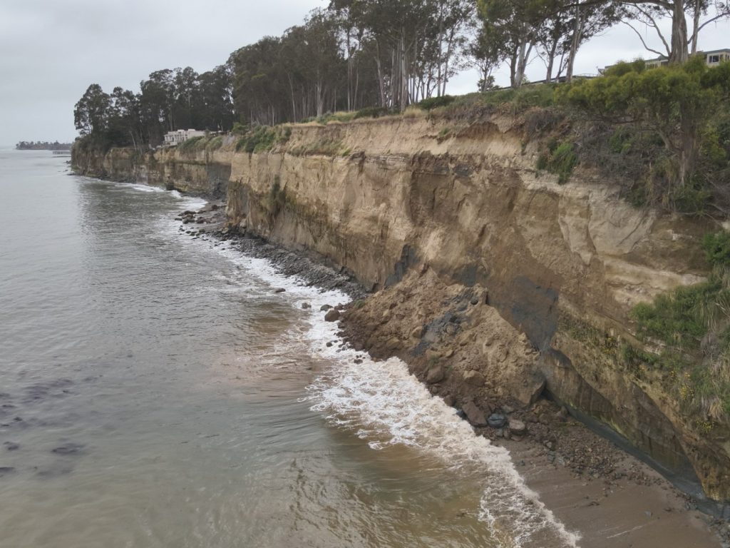
CAPITOLA — A large chunk of coastal bluff near New Brighton State Beach dropped into the ocean Wednesday and local authorities have cautioned the public to avoid the area.
Capitola police officers, alongside California State Parks Rangers, received reports of a partial landslide at a section of the bluff adjacent to the 800 block of Park Avenue.
It was not immediately clear how large of a slab broke off, but Capitola officials gave a rough estimate that it was at least 40 feet wide.
According to a social media post from the Capitola Police Department, no one was injured by the slide and Park Avenue is not directly impacted by the erosion, “but this serves as a great reminder to be aware of our surroundings, especially during high tide and near possibly hazardous sections of cliff,” police officials wrote.
Along the bluff above the slide runs the Santa Cruz Branch Rail Line, owned by the Santa Cruz County Regional Transportation Commission. Shannon Munz, a spokesperson for the commission, confirmed Thursday that its right-of-way ownership extends to the edge of the bluff and told the Sentinel that “unstable cliff” and “no trespassing” signs were set up in the area long before Wednesday’s silde . To be extra cautious, she said, the commission has propped up new barricades to ensure no one walks along that area of the scenic coastal cliff.
“At this point we really want to make sure people are not out there right now with all this movement happening,” said Munz, adding that the commission is likely to pursue a future project that establishes more permanent fencing in the area.
The slide occurred with the commission months away from completing a study that explores the feasibility of a zero-emission passenger rail project running 22 miles along the rail line from Watsonville to Santa Cruz. Munz said coastal erosion issues are already on the commission’s radar and its focus remains on getting the years-long study completed in early 2025.
“This is one of the widest parts of the rail line right-of-way and the tracks are a pretty good distance from the edge of the bluff,” said Munz. “This is something that we are aware of and looking at in our study, so we’ll have more information on alignments and things that would make the most sense once we’re done with the study.”
Meanwhile, at the commission’s meeting last week, its staff shared three vehicle types that could potentially be used to carry passengers within a train system as well as conceptual alignment details for the railway in order to accommodate a multiuse trail, appropriate travel times, scheduling and minimum train speed standards.
The commission has also planned a pair of public forums in Watsonville and Santa Cruz on June 24 and June 25, respectively. The events will give the public a chance to learn more about elements of the ongoing study and ask questions.
The Watsonville meeting will be held from 6-7:30 p.m. at 275 Main St. and the Santa Cruz meeting has been slated for the same hours the day after at 1900 17th Ave.


