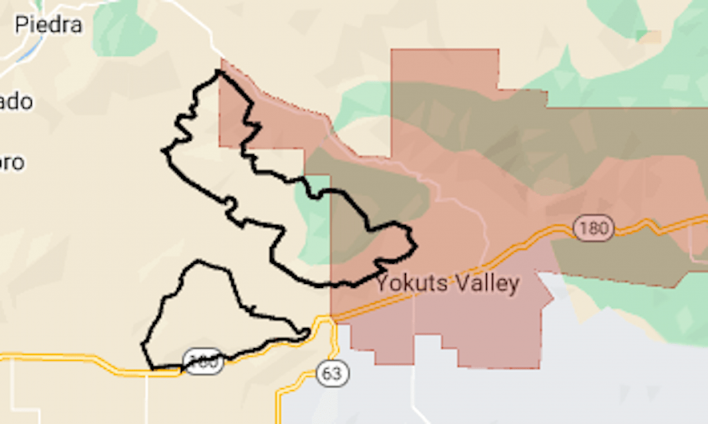
Two wildfires that have grown to within a mile of each other prompted evacuation orders Tuesday in the Sierra Nevada foothills east of Fresno.
Related Articles
For Bay Area weather, a return to normal after two electric days
Three-alarm wildfire scorches 34 acres in Newark
Grand Jury: Contra Costa County’s emergency warning system endangers residents
Heat, dry lightning keep firefighters busy with new California wildfire starts
Man arrested on suspicion of arson following San Jose park fires
The Bolt and Flash fires, which started June 24, are now classified as part of the Fresno June Lightning Complex, along with Hog and several smaller fires, the California Department of Forestry and Fire Protection said.
As of Wednesday morning, the complex had a combined area of 7,000 acres (11 square miles), CalFire said.
The map above shows the approximate perimeters of the Bolt and Flash fires as a black line and the mandatory evacuation area in red. For more details of the evacuation, including areas under warning, see Fresno County’s emergency map.
Highway 180 was closed through the fire area on Wednesday.


