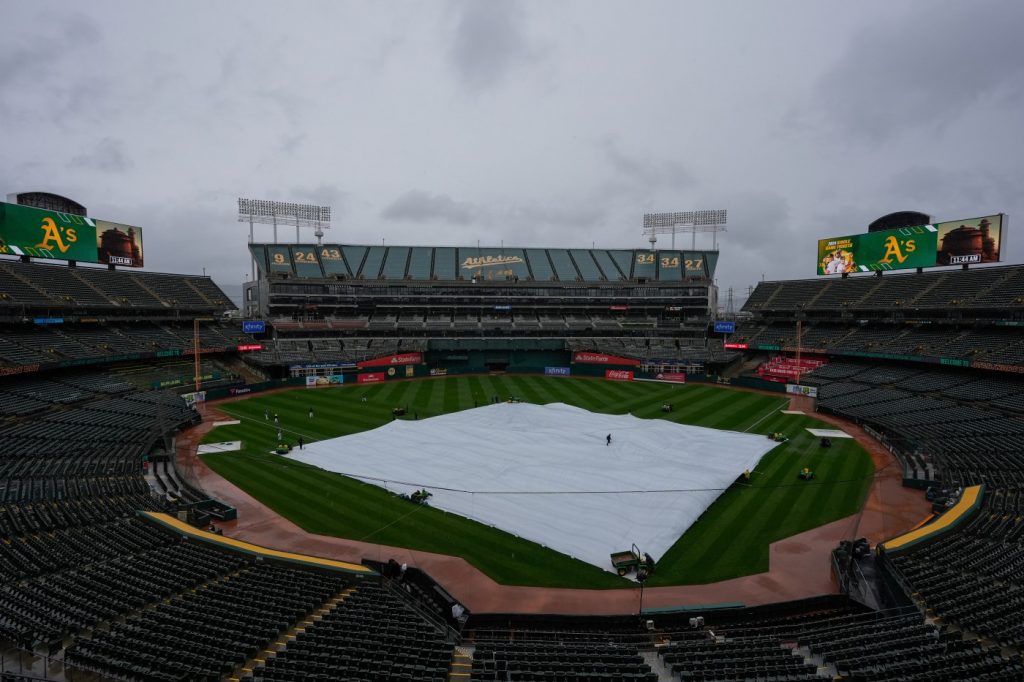
It wasn’t just your imagination. It rained a lot this past weekend in the Bay Area for this time of year. An awful lot.
Soaked by an unusually strong storm, San Jose recorded its wettest day Saturday of any day in the month of May in more than 100 years. The city received 0.67 inches — the most on any May date since 1915, and the third wettest May day since records began in 1897.
Even more fell in the East Bay.
At the Oakland Airport, the 0.73 inches Saturday ranked as the wettest day of any in May since May 20, 1957, when 1.11 inches fell, Dwight Eisenhower was president and most homes still had black-and-white TV sets.
In the Sierra Nevada, two feet of snow blanketed the mountains near Lake Tahoe over the weekend. The UC Central Sierra Snow Lab said the 26 inches that fell Sunday ranked as the snowiest day of this winter. Dozens of cars spun out, and the CHP put chain controls on Interstate 80 until the blizzard passed.
What happened?
“This was a good old-fashioned Gulf of Alaska cold front,” said Jan Null, a meteorologist with Golden Gate Weather Services in Half Moon Bay. “It was a classic winter storm. You could take the map and put a February date on it and say, ‘oh that looks right.’ It was not an unusual storm. But for this time of year it was unusual.”
This simulated radar loop from the High-Resolution Rapid Refresh computer model depicts precipitation overspreading Central California this afternoon. Precipitation will become confined to the Sierra Nevada and Kern County mountains tonight, before ending Sunday morning. #CAwx pic.twitter.com/psI44XoTQu
— NWS Hanford (@NWSHanford) May 4, 2024
Wet weather in May is not totally unheard of in the Bay Area.
May ranks as the 8th wettest month of the year, providing .7 inches on average for the month in San Francisco — about 3% of the Bay Area’s yearly precipitation. More than half of the Bay Area’s annual rainfall comes in December, January, and February. The only drier months than May are June, July, August and September.
Usually, that’s because a pattern of high pressure off the West Coast blocks most storms from reaching Northern California by April, signaling the end of the winter weather season and the beginning of summer-like conditions. The storm door closes, as forecasters often say.
This past weekend, however, that high-pressure ridge wasn’t around, and a decent-sized storm got through. It continued east, dumping snow in Utah and Colorado. For Northern California, odds are it will be the last significant rain storm until September or October, if history is any guide.
“It’s one of those things,” said Dalton Behringer, a meteorologist with the National Weather Service in Monterey. “It can just happen every now and then. Random luck.”
Winter ended six weeks ago, on March 19. Summer begins in about 6 weeks, on June 20.
“Sometimes the jet stream will briefly take a more winter-like southerly excursion — as occurred for a couple of days this past week — and bring one last meaningful precipitation event to California,” said Daniel Swain, a climate scientist at UCLA.
On Saturday, Oakland, San Jose, and San Francisco all received more rain in 24 hours than they usually receive in the entire month.
Downtown San Francisco’s total of 0.94 inches — the most of the big three Bay Area cities — ranked as the wettest day in May in more than a quarter century, since May 12, 1998 when 1.14 inches fell.
Saturday’s totals went even higher in some places, including 1.9 inches at Ben Lomond in the Santa Cruz Mountains, 1.89 inches at Mount Tamalpais in Marin, and 2.2 inches farther north in Fort Bragg on the Mendocino Coast.
The National Weather Service issued flood advisories Saturday across the Bay Area. In Palo Alto, a flooded underpass Saturday afternoon closed El Camino Real at University Avenue for several hours.
Fans who braved the Oakland A’s game endured a 3-hour-and-23-minute rain delay at the Oakland Coliseum before game finally started at 4:30 p.m. and the A’s eventually demolished the Miami Marlins 20-4.
5/5/24 9:35am Update:
Did anyone have the snowiest day of the 2023/2024 season being in May on their winter bingo card?
This storm dropped 26.4″ (67 cm) in the last day, making May 5th the snowiest day of the season at the lab. It beat 2nd place (March 3rd) by 2.6″ (6.5 cm)! pic.twitter.com/iEg01CyabX
— UC Berkeley Central Sierra Snow Lab (@UCB_CSSL) May 5, 2024
The wet weather brought significant benefits. It delays fire season. It preserves water because homeowners don’t need to run their lawn sprinklers. And it boosts reservoirs across the state, most of which are already full, or nearly full, guaranteeing urban residents won’t see water restrictions this summer.
As the Earth’s climate continues to warm, computer models show that May will likely be drier on average in Northern California than it is now, Swain said. But when storms do arrive, they can hold more water because more moisture evaporates into them due to the warmer temperatures.
“Extreme precipitation events in California at any time of year are somewhere between 5% to 15% more intense than they would have been in a cooler climate,” Swain said.
Had enough rain for now? The cold, wintery weather is over, forecasters say.
For the next 10 days, the Bay Area forecast calls for steadily warming temperatures, reaching into the 70s and 80s in most cities, with sunny skies. Gone will be the chilly conditions that marked this past weekend that brought overnight lows in the high 30s and 40s in some places.
“We have a bit of temperature whiplash coming up,” Behringer said. “From Wednesday onward we are looking at warmer-than-normal temperatures. Typical summer weather.”


