By Dave Collins | Associated Press
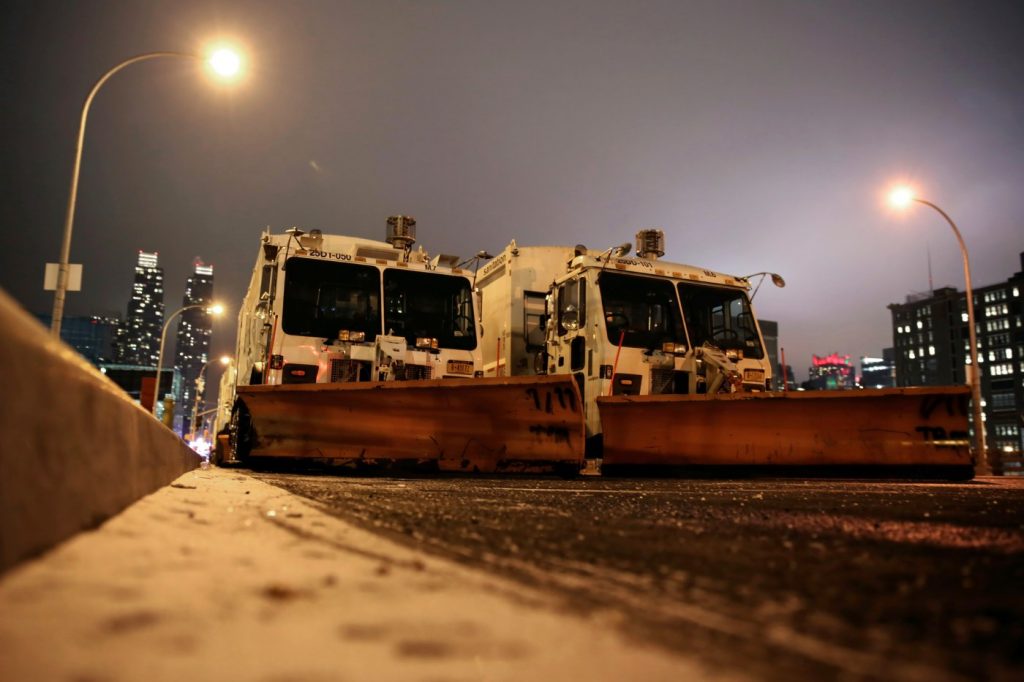
HARTFORD, Conn. — Parts of the Northeast were preparing Monday for a coastal storm that was expected to pack high winds and dump a foot or more of snow in some areas, leading to school closures, warnings against road travel and the possible disruption of flights.
The nation’s largest school system in New York City said it was switching to remote learning and closing its buildings Tuesday because of the impending storm.
“With several inches of snow, poor visibility on the roads, and possible coastal flooding heading our way, New Yorkers should prepare in advance of tomorrow’s storm and take the necessary precautions to remain safe,” New York City Mayor Eric Adams said in a statement. “If you do not have to be on the roads tomorrow, please stay home.”
Some of the highest snowfall totals were forecast for the northern suburbs of New York City and southwestern Connecticut, where 12 to 15 inches (30 to 38 centimeters) were possible, according to the National Weather Service. Wind gusts could hit 60 mph (100 kph) off the Massachusetts coast and 40 mph (65 kph) in interior parts of southern New England.
“It will make for a messy commute tomorrow morning,” Christina Speciale, a meteorologist for the weather service in Albany, New York, said Monday. “This is a fast-moving storm, so things should be cleared out by tomorrow afternoon.”
Massachusetts Gov. Maura Healey told all non-essential Executive Branch employees to not report to work Tuesday. Boston schools were closing and a parking ban was in effect. Similar closures and bans were put in place in other cities and towns. Emergency officials had equipment in place to help keep roads clear.
Boston Mayor Michelle Wu said the city’s homeless shelters would remain open.
“With the arrival of our first major snowstorm this winter, city teams are prepared to clear our roadways and respond to any emergencies during the storm,” Wu said.
Healey warned of downed power lines and coastal flooding, saying the heaviest snow would be from 9 a.m. to 2 p.m.
“Let’s be smart and not too glib about things,” Healey told reporters. “We haven’t seen big storms in some time but the teams are predicting that this is going to be a real storm.”
Rhode Island Gov. Dan McKee signed an executive order shuttering state government offices on Tuesday and banning tractor-trailer travel on all interstates and state roads beginning at midnight.
McKee said he issued the tractor-trailer ban in coordination with Massachusetts, Connecticut, and New York.
Transportation officials in Pennsylvania warned against unnecessary travel and said vehicle restrictions would go into effect early Tuesday on the Pennsylvania Turnpike and other major roads.
The city of Scranton said City Hall would be closed Tuesday, a public meeting on stormwater projects was cancelled, and parking downtown was banned to allow for rapid plowing of streets.
Airports in the region asked travelers to check with their airlines in case of cancellations and delays.
Power companies said they were preparing to respond to possible outages that could occur because of trees and branches falling onto electricity lines.
“The hazardous conditions can also make travel challenging for our crews, so we’re staging extra staff and equipment across the state to ensure we’re ready to respond as quickly as possible,” said Steve Sullivan, Eversource’s president of Connecticut electric operations.
The storm was expected to bring a mixed bag of weather to New Jersey. Most of the north and center of the state was expecting 8 to 12 inches (20 to 30 centimeters) of snow, more in some spots.
Rain was expected elsewhere in the state, with around an inch of snow possible toward the end of the storm if temperatures turned cold enough. The rain was forecast to start late Monday then turn to snow in northern areas early Tuesday. Officials said travel would be treacherous in north Jersey.
On Monday afternoon, dozens of shoppers loaded snow shovels and bags of ice melt into their cars at a Lowe’s Home Improvement Store in Stony Brook, New York, where up to 10 inches of snow was forecast.
“I’m just trying to make sure I’m prepared early,” said Mark Richardson, 29, as he unloaded a yellow shovel into the back of his SUV. “This will be the first big snowfall this year. All I have to do is get to the highway and I’m fine.”
Richardson, an ironworker, said he plans to shovel his driveway early Tuesday morning and try to make it to his regular commuter train into New York City.
At a news conference, New York City officials said that despite the snow predictions, they had no plans to relocate people from several large, heated tent shelter complexes built for thousands of homeless migrants.
“Those structures are designed to handle inclement weather,” said the city’s emergency management commissioner, Zachary Iscol. He said the city wasn’t expecting the type of strong winds or coastal flooding that prompted the evacuation of one of the tent shelters last month.
In the South, flood watches covered much of Alabama and parts of central Georgia on Monday. Up to 5 inches (12.7 centimeters) of rain was expected in parts of Georgia and Alabama, the National Weather Service warned.
Thunderstorms were rolling through both states Monday, and the rough weather also extended into the Florida panhandle.
Associated Press writers Steve LeBlanc in Boston; Jeff Martin in Atlanta; Mike Balsamo in Stony Brook, New York; Bruce Shipkowski in Toms River, New Jersey; and Ron Todt in Philadelphia contributed to this report.


